

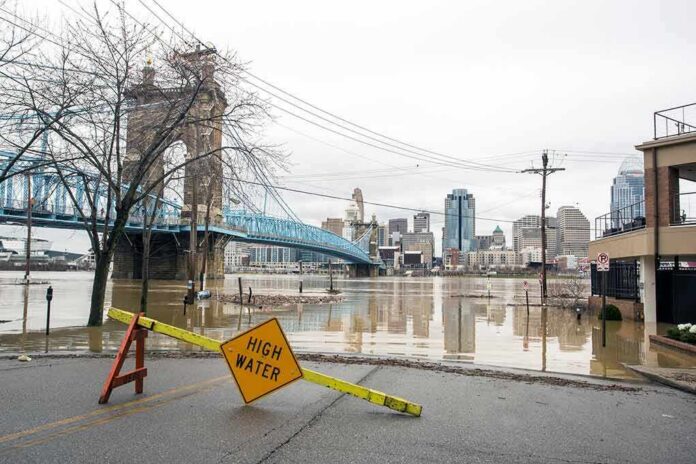
Governors across multiple East Coast states declared emergencies as a powerful nor’easter drove flooding, dangerous surf, and power outages into major population centers.
Story Snapshot
- New York and New Jersey leaders declared states of emergency ahead of life-threatening coastal flooding.
- Forecasts warned of one to three feet of coastal flooding and waves over 20 feet in parts of New England.
- Roads in New Jersey shore towns flooded as wind and high tide pushed seawater inland.
- Tens of thousands lost power as the storm knocked down trees and lines in several states.
Emergency Declarations Signal Serious Risk
New York’s governor declared a state of emergency for New York City, Long Island, and Westchester County as the storm moved in. New Jersey’s governor declared an emergency across eight counties expected to face the worst surge and wind. These steps free up resources, speed contracts, and allow faster aid. Officials urged people to avoid travel during high tide cycles. Event organizers canceled large outdoor events to reduce hazards and keep roads open for responders.
Federal briefings tracked similar actions further south. A Federal Emergency Management Agency daily operations update noted emergency declarations in Maryland, Virginia, and North Carolina during a comparable September coastal storm setup. That pattern reflects a standard playbook for nor’easters: act fast before conditions peak, then surge crews once winds ease. Local leaders said the main threats were water and wind, not snow or ice, and warned about flooding in low-lying neighborhoods and shore towns.
Forecasts Highlight Coastal Flooding, Wind, and Erosion
National and regional forecasts warned of coastal flooding of one to three feet above normal high tide for parts of the Mid-Atlantic and Northeast. Forecasters also cited very rough surf, rip currents, and pounding waves. Some New England waters could see waves topping 20 feet offshore, pushing dangerous surf onto beaches. Strong northeast winds were expected to topple trees in rain-softened ground and drive water into back bays and river mouths, where drainage is slow during high tide windows.
Television and local reports flagged beach erosion and dune stress in several shore communities. Reporters described seawater washing onto roads in places like Sea Bright and other barrier islands. Photos and live shots showed flooded streets, stalled cars, and crews closing lanes near inlets and causeways. With winds aligned for many tide cycles, even moderate surge could stack up. That set up repeat flooding at morning and evening highs, a common nor’easter pattern that wears down dunes and floods basements.
Travel, Power, and Local Impacts
Airlines offered change-fee waivers, and rail operators warned of weather delays as crosswinds and debris risks grew along the corridor. Road closures popped up in flood-prone shore blocks and near marsh crossings. Utility trackers reported tens of thousands without power at the storm’s peak. Crews staged bucket trucks and tree teams outside the highest-risk zones to speed restoration once winds fell below safe operating limits. Officials said downed lines posed a key safety threat during nighttime high tides.
2 AM Top-of-the-Hour News
Flooded streets. Downed trees and power lines. 150 thousand in the dark from Pennsylvania to Rhode Island. Hundreds of flights cancelled. Thousands more delayed. A powerful Nor-Easter slamming coastal areas from New Jersey to New England. New York… pic.twitter.com/yQGGcdEImV
— Worldwide News Network (@WorldwideNNX) September 27, 2026
Beach towns faced some of the most visible damage. Reporters pointed to dune erosion, washed-out access points, and overwash on select coastal roads. That included familiar hot spots along barrier islands that often take the brunt in nor’easters. Local leaders warned that repairing dune cuts and rebuilding beach access would take time and money. Residents were urged to keep vehicles off flooded streets to prevent wake damage and to check sump pumps, generators, and storm drains before the next tide cycle.
Why This Matters Beyond the Storm
This event shows how fragile key systems remain when water meets wind along a crowded coast. Families on both the left and right worry about basic competence: keeping the lights on, the roads clear, and first responders moving. Nor’easters test that promise. Fast emergency orders help, but they also expose slow fixes to old problems, like weak drainage, aging grids, and eroding dunes that protect homes and small businesses near the water.
Leaders now face practical choices. Cities can clear storm drains, harden substations, and map repeat-flood blocks for faster closures. States can fund dune work where it is most effective and update evacuation routes and signage. Federal agencies can align grants so locals do not drown in forms while streets drown in salt water. People do not expect miracles. They expect plans that work when the wind shifts and the tide rises again.
What Comes Next
As winds ease, officials will move from rescue to repair. Power crews will rotate to hardest-hit pockets to restore service. Inspectors will assess roads, bridges, and beach access points for hidden damage. Weather offices will compare forecasts to measured tides, gusts, and wave heights to refine future warnings. That cycle can feel routine, but it is how communities get better. A clear record of what failed and what held will guide smarter spending before the next nor’easter arrives.
Sources:
fmcsa.dot.gov, dhses.ny.gov, abcnews.com, weather.gov, drought.gov